
Description Garmin GPSMAP 66 series Handheld and Satellite Communicator Please note that 4 different products are available depending on the TOPO Mapping / InReach Technology / Multi-Band Technology options you select: Yes/Yes/No is the GPSMAP 66i (010-02088-01) Yes/No/Yes is the GPSMAP 66sr (010-02431-00) Yes/No/No is the GPSMAP 66st (010-01918-10) No/No/No is the…


Garmin GPSMAP 66 series Handheld and Satellite Communicator
-83% OffOriginal price was: $599.99.$99.00Current price is: $99.00.
Description
Description
Garmin GPSMAP 66 series Handheld and Satellite Communicator
Please note that 4 different products are available depending on the TOPO Mapping / InReach Technology / Multi-Band Technology options you select:
- Yes/Yes/No is the GPSMAP 66i (010-02088-01)
- Yes/No/Yes is the GPSMAP 66sr (010-02431-00)
- Yes/No/No is the GPSMAP 66st (010-01918-10)
- No/No/No is the GPSMAP 66s (010-01918-00)
Tired of regular hike trails? Venture out to unexplored terrains and conquer the toughest treks with GPSMAP 66i. This magical device is equipped to keep you safe with location tracking, sharing, two-way messaging and instant SOS alerts.
Preloaded with TopoActive maps of the U.S. and Canada, it paints a detailed picture of the terrain ahead and gives real-time weather updates. With a battery life of 35 hours in tracking mode and 200 hours in expedition mode, you are all set for the adventure of a lifetime.
FEATURES:
MULTI-GNSS SupportABC Sensors
Birdseye Satellite ImageryPreloaded TOPO MapsWikiloc TrailsTwo-Way MessagingInteractive SOS AlertsLocation SharingOptional inReach weather
SPECIFICATIONS:
Display Resolution: 240 x 400 pixels
Type: Transflective Color TFT
Battery Type: Rechargeable, Lithium-ion
Water Rating: IPX7
Interface: High-Speed micro USB and NMEA0183
Memory: 16 GB
External Memory: 32 GB
Waypoints: 10000
Tracks: 250
Track Log: 20000 points, 250 saved GPX tracks, 300 saved fit activities
Routes: 250 points per route, 50 auto-routing
Compass: tilt-compensated 3-axis
Geocaching Friendly
Connectivity: Wi-Fi, Bluetooth, ANT +
Dimensions: 2.5” x 6.4” x 1.4”
Weight: 8.1 oz
WHAT’S IN THE BOX:
GPSMAP 66i
Access to Birdseye Satellite Imagery
USB Cable
Carabiner Clip
Documentation
Related products
-

 -21% Off
Original price was: $109.00.$86.00Current price is: $86.00.
-21% Off
Original price was: $109.00.$86.00Current price is: $86.00.Description PRODUCT DESCRIPTION WHAT’S IN THE BOX SPECS EufyCam 2 Pro Add-On Camera Add extra security to your home with the eufyCam Pro 2 add-on camera. Featuring HD resolution and night vision capabilities this home security camera will provide you with peace of mind, day and night. The camera is completely wireless…
-
 -40% Off
Original price was: $83.99.$50.40Current price is: $50.40.
-40% Off
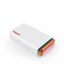
Original price was: $83.99.$50.40Current price is: $50.40.Description PRODUCT DESCRIPTION WHAT’S IN THE BOX SPECS Polaroid Hi-Print Instant Film Pocket Printer The Polaroid Hi-Print is a Bluetooth photo printer for your smartphone. Carry it wherever you go and print memories in just a few seconds. This smartphone pocket printer uses a special dye-sublimation technology to print colorful high-quality images.…
-
 -70% Off
Original price was: $279.99.$85.00Current price is: $85.00.
-70% Off
Original price was: $279.99.$85.00Current price is: $85.00.Description PRODUCT DESCRIPTION WHAT’S IN THE BOX SPECS Timekettle WT2 Edge Real-time Translator With the WT2 Edge, it’s always your turn to speak. It’s the first earbuds to offer truely bi-directional simultaneous translation, meaning you can speak and hear other people’s translations at the same time.- Bi-Directional Translation- Multi-Person Meeting-…
-
 -40% Off
Original price was: $69.00.$41.40Current price is: $41.40.
-40% Off
Original price was: $69.00.$41.40Current price is: $41.40.Description PRODUCT DESCRIPTION WHAT’S IN THE BOX SPECS 360 G300H Dash Camera Front Wi-Fi Discover the 360 G300H Dash Camera which creates a HD and natural video quality. With 6 full-HD spherical lenses and IR filter, it allows you to get a superior HD video quality during both day and…


