
Description Garmin GPSMAP 67i GPS Handheld Utilize this high-end, tough GPS handheld and satellite communicator to spend more time on adventures. Get in touch with inReach® technology to benefit from two-way messaging, interactive SOS alerts, location sharing, and navigational mapping to help you stay on course. Travel longer with up…


Garmin GPSMAP 67i GPS Handheld
-86% OffOriginal price was: $599.99.$85.00Current price is: $85.00.
Description
Description
Garmin GPSMAP 67i GPS Handheld
Utilize this high-end, tough GPS handheld and satellite communicator to spend more time on adventures. Get in touch with inReach® technology to benefit from two-way messaging, interactive SOS alerts, location sharing, and navigational mapping to help you stay on course.
- Travel longer with up to 165 hours of battery life in tracking mode and up to 425 hours in expedition mode.
- Two-way messaging lets you share the moment with the ones who matter.
- Let your loved ones follow your adventure with location tracking.
- Have an emergency? Trigger an interactive SOS alert anytime, globally.
- Track your position in challenging conditions with multi-band technology and expanded GNSS support.
inReach Technology: Two-way messaging via the 100% global Iridium®; trigger an interactive SOS to the 24/7 staffed search and rescue monitoring center (satellite subscription required).
What’s in the box
- GPSMAP 67i
- Type A to Type C USB cable
- Carabiner clip
- Documentation
MULTI-BAND GNSS SUPPORT
Access multiple global navigation satellite systems (GPS, Galileo and QZSS). Get access to multiple frequencies sent by navigation satellites for improved position accuracy in areas where GNSS signals are reflected, weak or typically don’t penetrate.
ABC SENSORS
Navigate every trail with ABC sensors, including an altimeter for elevation data, barometer to monitor weather and 3-axis electronic compass.
SATELLITE IMAGERY
Download high-resolution, photorealistic maps directly to your device via Wi-Fi® technology. Easily find trails, pick stand locations and parking, create waypoints and more.
PRELOADED TOPO MAPS
Preloaded TopoActive U.S., Mexico and Canada maps show you terrain contours, topographic elevations, summits, parks, coastlines, rivers, lakes and geographical points.
PREMIUM MAP FEATURES
With an Outdoor Maps+ subscription, you get public land information, landowner names, state plat maps, hunting management unit boundaries, BLM boundaries and more.
BATTERY LIFE
Turn on expedition mode, and get up to 425 hours of battery life while using inReach technology. In the default tracking mode, you get up to 165 hours of battery life, and your device will save your location every 10 minutes.
Specifications
General |
|
| 2.5” x 6.4” x 1.4” (6.2 x 16.3 x 3.5 cm) | |
| 1.5″W x 2.5″H (3.8 x 6.3 cm); 3″ diag (7.6 cm) | |
| 240 x 400 pixels | |
| transflective color TFT | |
|
8.1 oz (230 g) with batteries |
|
| IPX7 | |
| rechargeable, internal lithium-ion | |
|
Up to 165 hours with inReach® enabled with 10 minute trackingUp to 180 hours in GPS ModeUp to 425 hours in Expedition mode with inReach enabledUp to 840 hours in Expedition mode |
|
| yes (thermal, shock, water); bare unit only | |
| USB-C | |
| 16 GB (user space varies based on included mapping) | |
Maps & Memory |
|
|
yes (TopoActive, routable) |
|
| 15,000 | |
| yes (direct to device) | |
| yes (32 GB max microSD™ card) | |
| 10,000 | |
| 250, 200 course points per course | |
| 250 | |
| 20,000 points, 250 saved gpx tracks, 300 saved fit activities | |
| 250, 250 points per route; 50 points auto routing | |
Sensors |
|
| Yes (tilt-compensated 3-axis) | |
Daily Smart Features |
|
Safety and Tracking Features |
|
Outdoor Recreation |
|
| yes (Geocache Live) | |
| yes (500 custom map tiles) | |
inReach® Features |
|
Outdoor Applications |
|
Connections |
|
|
yes (Wi-Fi®, BLUETOOTH®, ANT+®) |
|
Related products
-
 -84% Off
Original price was: $599.99.$97.00Current price is: $97.00.
-84% Off
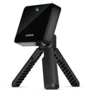
Original price was: $599.99.$97.00Current price is: $97.00.Description PRODUCT DESCRIPTION WHAT’S IN THE BOX SPECS Garmin Approach R10 Golf Launch Monitor & Indoor Simulator Practice and play anytime with the Garmin approach R10, the new golf launch monitor and Indoor Simulator from Garmin, combining all the features of existing launch monitors and simulators into one portable unit. As it includes…
-
 -27% Off
Original price was: $119.99.$87.00Current price is: $87.00.
-27% Off
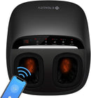
Original price was: $119.99.$87.00Current price is: $87.00.Description Etekcity EM-SF3 Smart Shiatsu Foot Massager Sweet relief to your tired feet after a long day, the EM-SF3 Smart Shiatsu Foot Massager is a great choice to pamper your aching soles. Effortlessly easy to use with 3 massage modes, 3 massage intensities, soothing heat, and timer settings, you can…
-
 -22% Off
Original price was: $109.00.$85.00Current price is: $85.00.
-22% Off
Original price was: $109.00.$85.00Current price is: $85.00.Description Our 3L Evergreen Watering Can is handcrafted out of brushed stainless steel with a powder coated finish. Its slender base sits seamlessly on a windowsill, shelf or amongst lush plants. A long spout with controlled flow makes it easy to feed both drought-tolerant and water-loving plants. Rust-resistant. Because this…
-
 -88% Off
Original price was: $714.99.$88.00Current price is: $88.00.
-88% Off
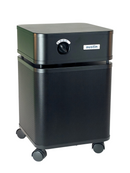
Original price was: $714.99.$88.00Current price is: $88.00.Description PRODUCT DESCRIPTION WHAT’S IN THE BOX SPECS Austin Air HealthMate HM400 HEPA Air Purifier A Clinically Proven, Medical Grade Air Purifier The Austin Air HealthMate Air Purifier is made to help you monitor and control your air quality inside your house or your office. It catches a huge variety of…