Description Garmin Zumo XT2 MT-S Motorcycle Navigator Rev your engine and explore far and wide with the Garmin Zumo XT2 MT-S motorcycle navigator. Its robust 6” display is glove-friendly and designed to help you find the most thrilling routes, no matter where your adventures take you. The bright 6” display…


Garmin Zumo XT2 MT-S Motorcycle Navigator
-86% OffOriginal price was: $599.99.$85.00Current price is: $85.00.
Description
Description
Garmin Zumo XT2 MT-S Motorcycle Navigator
Rev your engine and explore far and wide with the Garmin Zumo XT2 MT-S motorcycle navigator. Its robust 6” display is glove-friendly and designed to help you find the most thrilling routes, no matter where your adventures take you.
- The bright 6” display is easy to read, no matter the weather or light conditions.
- Create custom routes with the visual route planner.
- Find the twists and turns with the Garmin Adventurous Routing™ setting.
- See popular moto paths to discover new places to ride.
- Start a group ride to see positions of other riders on the zūmo XT2 display1.
- Switch from North America street maps to topographic maps to satellite imagery with just a tap.
What’s in the box
- zūmo XT2
- Motorcycle mount and hardware
- Motorcycle power cable
- USB cable
- Documentation
ULTRABRIGHT DISPLAY
The 6” display is 15% larger than previous models and features an even brighter HD resolution in landscape or portrait mode.
DESIGNED TO ENDURE
Rain? Vibration? Dust? Doesn’t matter. This device is built to withstand all kinds of weather (IPX7) and rough terrain.
VISUAL ROUTE PLANNER
Plan a custom route on the device, or use the Tread app with a compatible smartphone.
SIMPLE MAP SWITCHING
Quickly toggle between on-road maps, topographic maps and satellite imagery, so you can always have the perfect map for your ride
GROUP TRACKING
Use the Tread app on your smartphone and/or zūmo XT2 device to track friends with the Group Ride Mobile feature1. Or, use the Group Ride Radio accessory2 (sold separately) for tracking other zūmo XT2-equipped riders with no cellular coverage needed.
SATELLITE IMAGERY
Use satellite imagery from around the world to help you navigate. Download the maps directly to your device via Wi-Fi® technology3. No annual subscription required.
POPULAR PATHS
See popular moto paths ridden by other riders to find new and exciting routes to explore.
GARMIN ADVENTUROUS ROUTING
Straight roads are boring. Find the most thrilling routes with hills, curves and sights, and choose from 4 levels of difficulty.
RIDE SUMMARIES
Use the Tread app to review your ride details, including speed, acceleration, decelerations, elevation and more.
TRACK RECORDER
Record your ride data such speed, distance, acceleration and more and share the details with friends on Tread app.
SHARE YOUR FAVORITE ROUTES
Easily send GPX files from your phone or third-party sources to your zūmo XT2 navigator. Share GPX files with fellow riders by using the Tread app.
General |
|
| 6.15″W x 3.5″H x 1″D (15.6 x 8.9 x 2.5 cm) | |
| 5.3″W x 3.0″ H (13.3 x 7.5 cm); 6″ diag (15.3cm) | |
| 1280 x 720 pixels | |
| multi-touch, glass, high brightness HD color TFT with white backlight | |
|
12 ounces (340 g) |
|
| IPX7 | |
| rechargeable lithium-ion | |
|
up to 6 hours (up to 3.5 hours at 100% backlight) |
|
| MIL-STD-810 | |
Maps & Memory |
|
| microSD™ card (not included) | |
| 32 GB | |
| yes (256 GB max microSD™ card) | |
| yes (BirdsEye) | |
Sensors |
|
Outdoor Recreation |
|
Navigation Features |
|
| yes (with Garmin Tread app) | |
| yes (works with BLUETOOTH-compatible helmet, headset or smartphone. BLE capable.) | |
Advanced Features |
|
Motorcycle Features |
|
Adventure Features |
|
| yes (6″, 8″ and 10″) | |
Group Ride Radio |
|
| compatible with Group Ride Radio | |
| compatible with Group Ride Radio | |
| compatible with Group Ride Radio | |
| compatible with Group Ride Radio | |
Related products
-

 -60% Off
Original price was: $239.00.$96.00Current price is: $96.00.
-60% Off
Original price was: $239.00.$96.00Current price is: $96.00.Description Modern Sprout Smart Growhouse Modern Sprout’s Smart Growhouse makes sustaining a year-round garden inside of your home not only doable, but beautiful. A watertight planter allows for easy planting, watering, and harvesting. Stylish and multi-functional, the Smart Growhouse is perfect for an endless variety of kitchen herbs and leafy…
-
 -79% Off
Original price was: $444.00.$94.00Current price is: $94.00.
-79% Off
Original price was: $444.00.$94.00Current price is: $94.00.Description PRODUCT DESCRIPTION WHAT’S IN THE BOX SPECS Coway Airmega 300 HEPA Air Purifier The new Coway Airmega 300 Smart air purifier is a perfect device to find relief from allergy or asthma symptoms. Airmega 300 comes with a dual stage filtration system which helps in removing nearly all harmful…
-
 -86% Off
Original price was: $649.99.$94.00Current price is: $94.00.
-86% Off
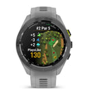
Original price was: $649.99.$94.00Current price is: $94.00.Description Garmin Approach S70 Premium Golf Smartwatch A whole-in-one premium GPS golf watch, the Approach S70 from Garmin, a stylish wrist-wear to keep you fit both on and off the course. Featuring a super bright 1.4″ Amoled touchscreen display with 43000+ preloaded courses from across the world, Garmin’s Approach S70 gives your game…
-
 -40% Off
Original price was: $72.27.$43.40Current price is: $43.40.
-40% Off
Original price was: $72.27.$43.40Current price is: $43.40.Description PRODUCT DESCRIPTION WHAT’S IN THE BOX SPECS Click & Grow The Smart Garden 3 The Smart Garden 3 is an innovative indoor garden that cares for itself and grows fresh, flavourful herbs, fruits and vegetables for you. Experience all the benefits of having your own garden, no matter…